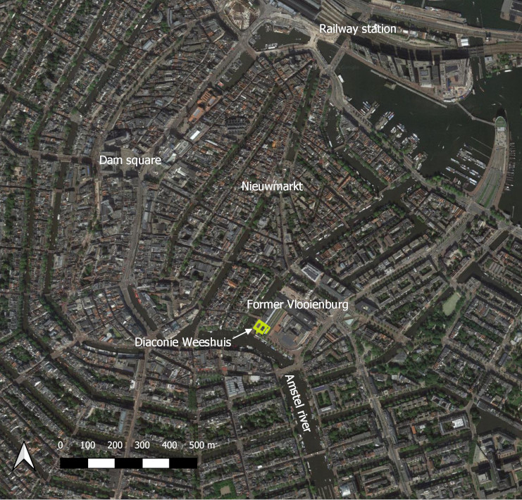
In the latter half of the 17th century, the Diaconie Weeshuis, an Amsterdam orphanage managed by a protestant church, proudly overlooked the Amstel river. It was located on former ‘Vlooienburg’, an island constructed in the Amstel river for urban expansion around 1600. The orphanage was constructed in 1656, after the plague epidemic of 1654-55 which had turned many children to orphanhood. It was sited on a previously unbuilt quay area on the edge of Vlooienburg. To make space for this large building, a new strip of land had to be reclaimed from the Amstel river. This building stood here for 230 years before it got replaced by a new orphanage building in Neogothic style in 1888. Neither of the two buildings have survived, and especially for the older building there are only few remaining visual sources. This 3D reconstruction for the first time synthesises these sources into a model of this lost piece of architecture of Amsterdam.

Click image to enlarge. Current map of Amsterdam (google maps) with location of Diaconie orphanage and various landmarks.
The model of the protestant orphanage is one small piece of a much larger multi-period 3D model of the Vlooienburg neighbourhood. Since the early 17th century Ashkenazi and Sephardic jews had settled here. In the century that followed, Vlooienburg and the surrounding areas transformed into the jewish neighbourhood of Amsterdam, until its harsh end as a result of the holocaust in the second world war. Already before the second world war, the neigbourhood had impoverished and many houses were left in a bad condition. Against heavy protest, the entire neighbourhood was demolished to make space for the new Amsterdam city hall and opera (nick named ‘stopera’) in the 1980s.
Click image to enlarge. Vlooienburg at the end of the 19th century as seen towards the south. The 1888 version of the Diaconie orphanage - so, a different building than displayed in the model - is visible in the middle right side of the picture (Photo by G.H. Heinen).
Click image to enlarge. Photo taken from the same perspective in 2020. The houses were replaced by the municipial hall and opera house in the 1980s (Photo by Tijm Lanjouw).
The Vlooienburg 3D model was created within the Diaspora & Identity project, a research project aimed to study expressions Jewish identity from an archaeological, dietary and material culture perspective. The purpose of the model was to visualise the physical urban transformations of this neigbourhood until its demolition, in order to provide a spatial, locational, and visual dimension to the study of different aspects of Jewish life. The model aims to give a comprehensive picture of the entire Vlooienburg island through the ages, and therefore includes not only buildings with a particular jewish origin or heritage.