Comparison between the map of Dou and the one of Bast ca. 1600
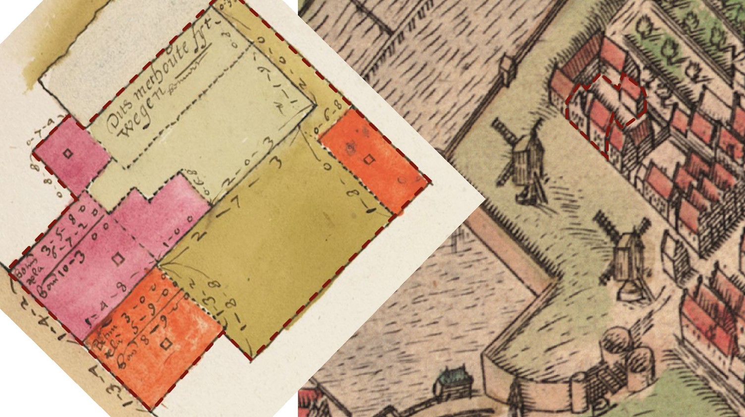
The second step in the reconstruction process was to conduct a volumetric study of what was known as the Mill House. The study involved two key components: firstly, the creation of a plan, and secondly, determining the height and orientation.An invaluable source for creating the plan was a map made by the famous cartographer Jan Pietersz. Dou (1572-1635). This map was created after the passing of Rembrandt's grandmother to illustrate the division of the north side of the Mill House as part of her inheritance. It provided detailed information on plot dimensions and existing buildings. Although the map used Rhineland Rod measurements, they were easily converted to the metric system. Additional pieces to complete the puzzle of making the plan mostly came from early 19th-century cadastral maps. Upon studying these maps, it was discovered that the core of the Mill House should have still been present during that period. Therefore, in turn, also reaffirming the position of his birthplace. Determining the height and orientation of the Mill House, the second step in the volumetric study, relied on a combination of written sources and various image sources. Once again, Dou's map proved to be useful. Dou's map also indicated the number of stories through drawn "squares," indicating that all the buildings were one story high. While the exact dimensions were unknown, they could be inferred from still-existing contemporary buildings in Leiden. Another invaluable source was the bird's-eye view from Pieter Bast ca. 1600. Comparing this map with data from over 20 years of building archaeological research in Leiden, one can confidently state that this map is remarkably accurate for its size. Analyzing the image sources alongside written archival records revealed that there were three houses placed transversely, with an attached perpendicular volume to the southernmost one. The northernmost house featured a crow-stepped cross gable.Determining the height of the roof relied on the common roof pitch of houses in Leiden, which typically ranged between 55 to 59 degrees. Fortunately, a stroke of luck occurred when a photo of the house's roof was discovered by zooming in on a picture of the Zeevaartschool taken in 1850. This photo provided evidence supporting the volumetric reconstruction of the house.
Comparison between the map of Dou and the one of Bast ca. 1600