Left: The late Roman wall and tower from Tongeren. © J. Lendering, CC0 1.0 Universal, via Livius.org.
Right: Reconstruction of the double horreum at the Saalburg archaeological park. © I. Gorinin, 2007. CC BY-SA 3.0, via Wikimedia Commons
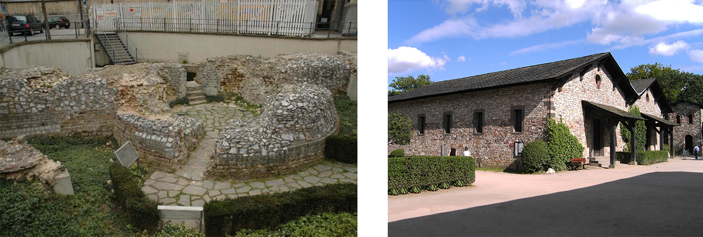
The castellum at Maastricht did not exist in isolation. It formed part of a wider network of late Roman river forts and fortified settlements along the Meuse and within the Civitas Tungrorum, many of which were strengthened in the 4th century as part of broader frontier reforms after the 3rd century crises. To better understand the fragmentary remains in Maastricht, the research team explored aspects of a few comparable sites in the region (i.e., Aachen, Boppard, Cuyck, Deutz, Heerlen and Tongeren). 'Case cards' for these sites were made in which key information was summarised, such as the site plan, wall dimensions, tower forms, gate types, internal buildings and phasing, as well as references to published literature on the site.
These case cards (as well as other analogic visual sources from further afield) served as practical interpretive tools to guide discussions that informed the 3D workflow. When the evidence at Maastricht was unclear—for example, the likely height of the walls, the spacing of the towers, or the layout of interior buildings—the team could consult sites with similar dates, functions and riverine settings. Agreements and differences between these analogies and the Maastricht data were discussed, helping to distinguish well‑supported decisions from more tentative ones.
By making these comparisons explicit, the 3D reconstruction becomes a visual map of scholarly reasoning rather than a singular, authoritative image. Viewers are encouraged to see the castellum not as a definitive “before and after” picture, but as one carefully argued possibility grounded in regional evidence, critical comparison and transparent documentation.
Left: The late Roman wall and tower from Tongeren. © J. Lendering, CC0 1.0 Universal, via Livius.org.
Right: Reconstruction of the double horreum at the Saalburg archaeological park. © I. Gorinin, 2007. CC BY-SA 3.0, via Wikimedia Commons