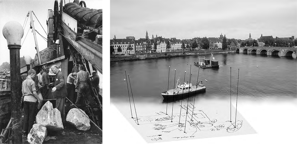
Although noted in historical texts, the physical remains of the bridge was first noted only in 1915 by city archivist Goossens as a result of extremely low water levels in the Meuse for that season. However, it wasn’t until 1963 when the Rijkswaterstaat – Ministry of Infrastructure and Water Management (RWS) cited the existence of foundation piles as a navigational hazard for shipping and thus they required removal for this reason. This led to a joint extraction process together with the National Service for Archaeological Heritage (ROB), which confirmed the existence of the Roman-period bridge as well as shedding significant light on the social status and changing demographic profiles of the elite residents of the immediate Maastricht region in the civilian phase of its occupation (Panhuysen 1996).
This underwater rescue excavation led to the removal of monumental and architectural spolia from the flourishing 1st and 2nd century pre-crisis period. Spolia is defined as recycled objects re-used in a new architectural context. It was a common practice throughout Europe in the late 3rd and early 4th centuries in an effort to restore infrastructure and (re)rebuild fortifications after the destruction and economic recession of the 3rd century crisis. In particular, grave monuments were frequently re-used in the foundations of newly constructed buildings.
In Maastricht, these pieces of monumental grave sculptures and architectural fragments of the former sanctuary had been dumped into the river in and around the original foundation piles during the 333 CE castellum construction phase in order to repair or reinforce the bridge as a stable crossing point, alternatively they were possibly deposited as breakwaters in front of the piers (Panhuysen 1996). In addition to the spolia remains, the ROB campaign discovered the remains of heavy oak piles capped with iron pile shoes and rammed into the riverbed in a regular arrangement.
The latest investigation into the Roman bridge occurred in 1998-2000, in which sonar mapping and diving surveys were conducted over a c. 400 square meter area to accurately locate and map the bridge’s remains as well as to identify, date and assess the preservation state of the underwater material remains (Souter, 2000; Vos, 2004). This activity revealed three different structures for the bridge, tentatively interpreted as at least three (or four and potentially more) phases of bridge-building across its 300-year use by the Romans.