© AI MAINZ/ Igor Bajena, 2020
Most of the development around the church site consisted of homesteads with wooden dwellings and farm buildings. The exact location or form of these buildings is not known. The reconstructed fences are made of branches and wooden stakes. A symbolic gate marks the entrances to the plots in the form of three wooden logs, two of which are shafts, supported by a transversely located third log. The density of urban development was estimated on the basis of a study published in the Mainzer Zeitschrift (Jung & Kappesser, 2007).
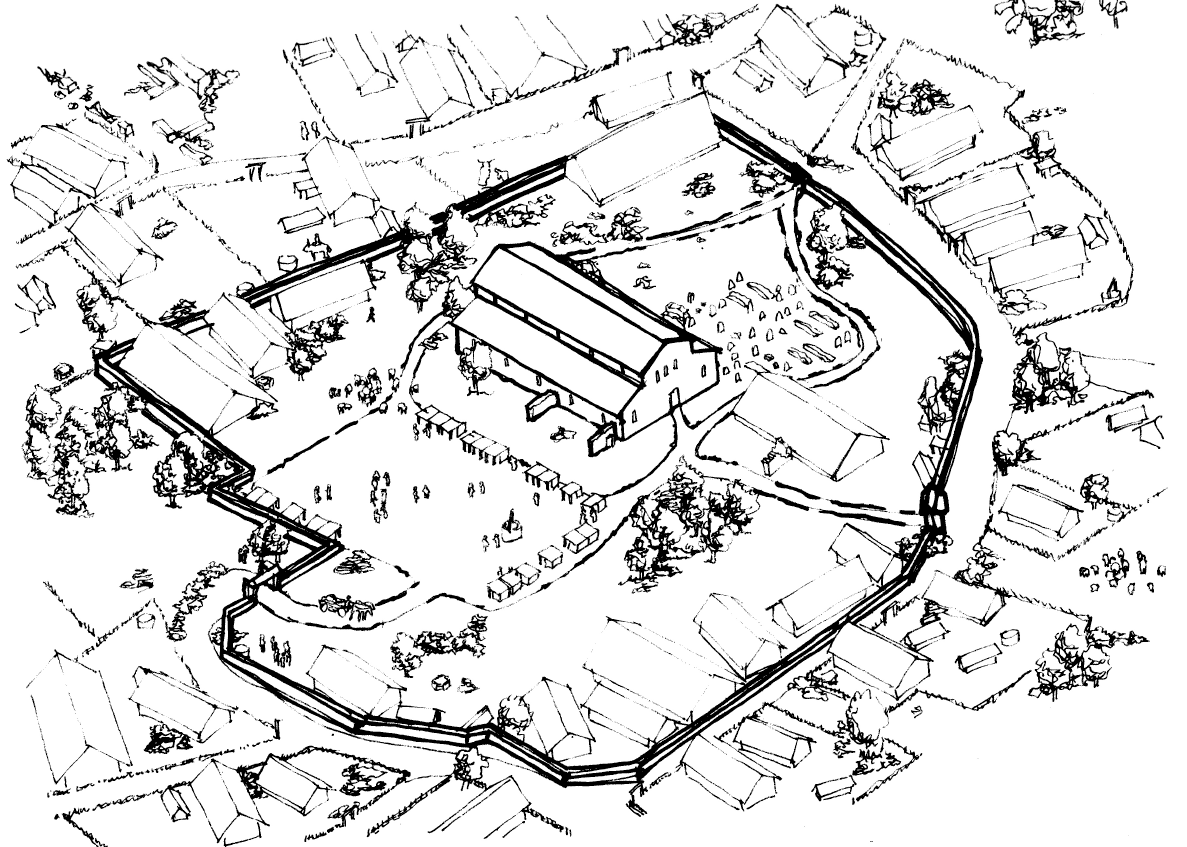
Due to the importance of the role played by St John's Church during this period, it was assumed that the parcel would be divided into four functional areas: the wooden housing and farm buildings area, the market area, the cemetery and the church complex. Initially, the church was reconstructed as a single building, and the remains of the walls on the north side were presented as the ruins of a previous phase of the building, which had been demolished. More to the north was placed the market place and to the south the cemetery. Wooden buildings have been placed on the eastern and western sides of the site.
However, the archaeological work progress on the site has brought significant changes to the area arrangement. The remains of the walls on the north side of the church have been interpreted as the nucleus of additional buildings of the church complex in the form of a cloister, an L-plan convent together with a single-storey side extension. This hypothesis also corresponded to the form of the complex in 1200. These buildings occupied the area of the previous location of the market, which was moved to the western part of the plot. The cemetery area was also extended.
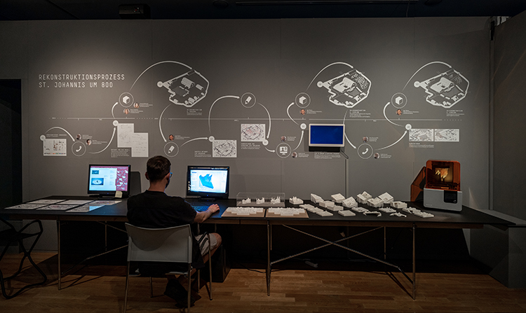
The whole process of digitally reconstructing the area, from the first archival research to finishing the modelling of the final version, took about 15 months. Despite deciding on the final variant, the other variants were also considered to contain some scientific value. The entire process was documented and presented in the exhibition "Digital Urban History Lab" at the Mainz State Museum (Landesumuseum Mainz), where 3D prints of each variant of the area reconstruction can be viewed up close.
────────────────────────────────────────
BIBLIOGRAPHY
1. Digital Urban History Lab, https://landesmuseum-mainz.de/de/ausstellungen/digital-urban-history-lab/.
2. Jung, P., & Kappesser, I. (2007). Die Bearbeitung raumbezogener Informationen mit den ‘tabulae MoGontIacenseS (Mogis)’ und das römische Mainz in der Spätantike. Mainzer Zeitschrift, 102, 33–51.