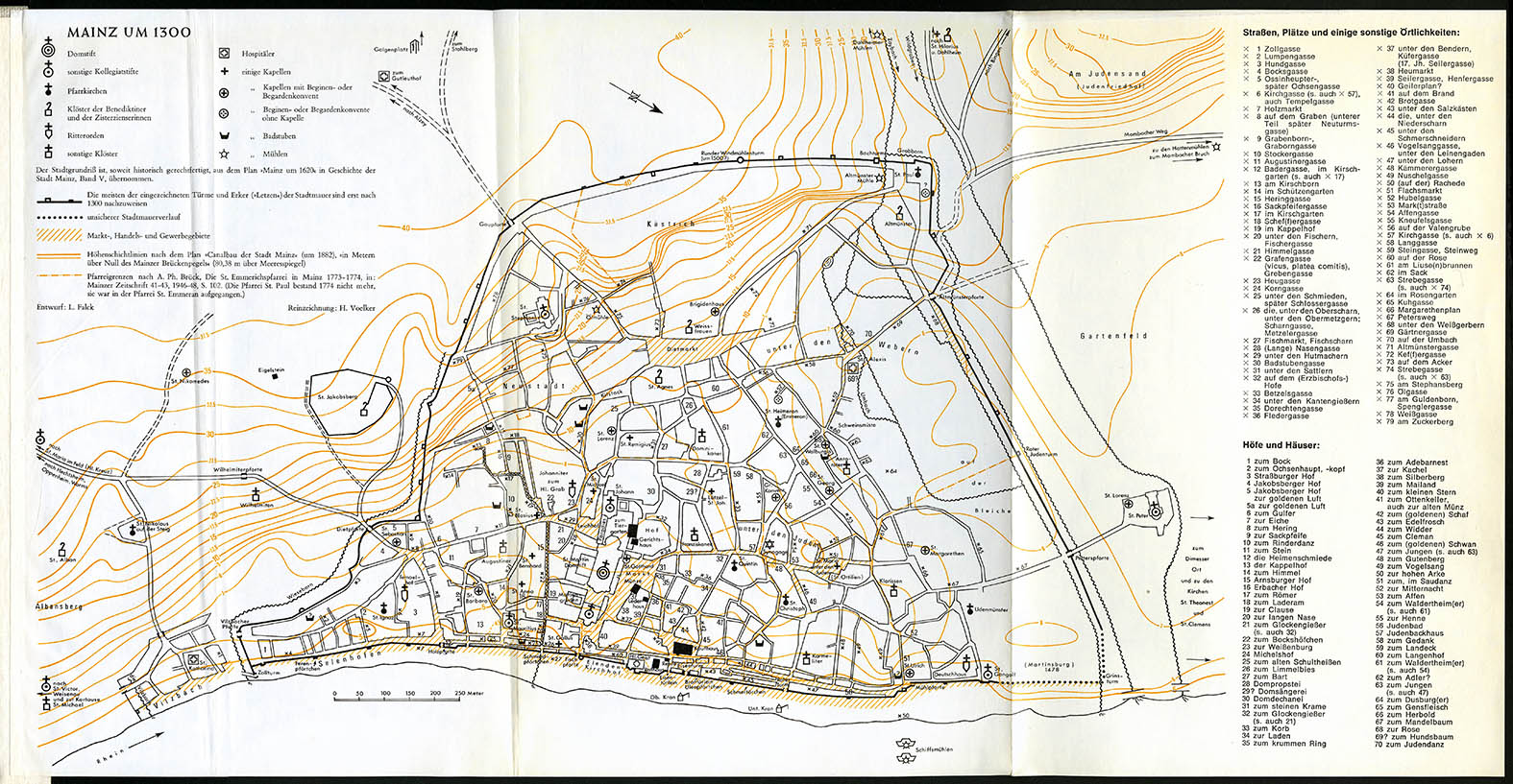
Reconstructing the city's road system was a difficult task, due to the fact that the first map documenting the city is the Schwedenplan, dates from 1625/1626 and (City Archive Mainz, BPSP / 55 D; "Schwedenplan" because it was confiscated by the Swedes during the Thirty Years' War). Historical studies undertaking reconstructions of the city's road system in earlier years should be consider highly uncertain. A publication containing the earliest road system from 1300 was presented by H. Voelker based on the plan "Mainz around 1620" published by Ludwig Falck in the fifth volume of the "History of the City of Mainz" in 1972.
In order to use a hypothetical layout 500 years earlier, a reduction in the number of roads was carried out based on consultation with historians of the Carolingian period in Mainz. Mainly secondary roads that may not have existed at that time were eliminated. Most of the main roads remained unchanged. The roads were not paved. The parcels of land thus separated were divided by fences into smaller plots - most of them completely hypothetical.
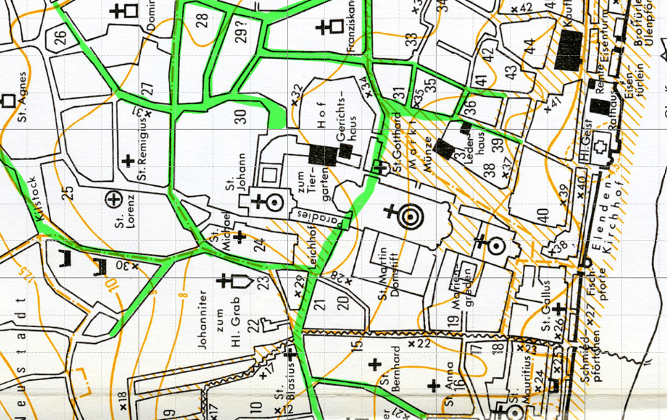
The church area was outlined around the excavation site by inserting a wall along the surrounding roads. Entrances were inserted in the wall where the main roads end at the parcel border of the church. There are two main entrances (leading to the market) and two side entrances. The internal communication system is entirely hypothetical. Its development was dictated by ensuring the area's functionality: All entrances are leading to the church, the cloister or the market square.